What Catchment Am I In?
Which stream does the rain on your land run into, which river does that join, and who else shares it? Follow the water, and you have your catchment. Here is how, on a real farm.
A catchment is all the land that drains to the same stream, river or lake. Its edge is the ridgeline: rain on one side runs one way, rain on the other side runs the other. Catchments nest inside each other. The land draining to your creek is a sub-catchment of the river the creek joins, which is a sub-catchment of a bigger river again, all the way to the sea.
So “what catchment am I in?” has more than one right answer. For a council it may be a big river and its freshwater management unit. For a catchment group it is usually the local stream. For a farm plan, the guidance asks you to understand your operation “as a part of your local catchment or sub-catchment” (MfE, Developing a freshwater farm plan). The way to all of them is the same: follow the water.
Catchment and sub-catchment, in one picture
- Your land drains to the nearest swale, gully or drain.
- Your sub-catchment is all the land draining to your local stream where it leaves your place: you and your upstream neighbours. Often a few hundred to a few thousand hectares.
- The catchment is the land draining to the river your stream joins, the scale councils and catchment groups usually name.
What happens on any land in a catchment ends up in the water below it. That is why the question comes up in a farm plan, a water-quality result or a catchment group meeting: the stream outside your gate carries everything upstream of it.
Follow the rain from your land
Click any spot. Downhill Path traces where the water runs over the LiDAR ground model and how far it goes before it reaches a stream. Free to use, no login.
Open Downhill Path →Find yours in six steps
The example is a dairy and drystock farm on the edge of the Piako flats in the Waikato, below the Hapuakohe Range. The numbers are what the tools gave on 19 November 2026.
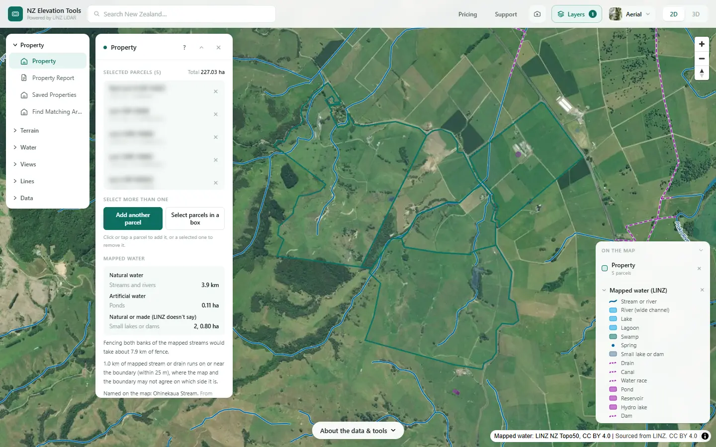
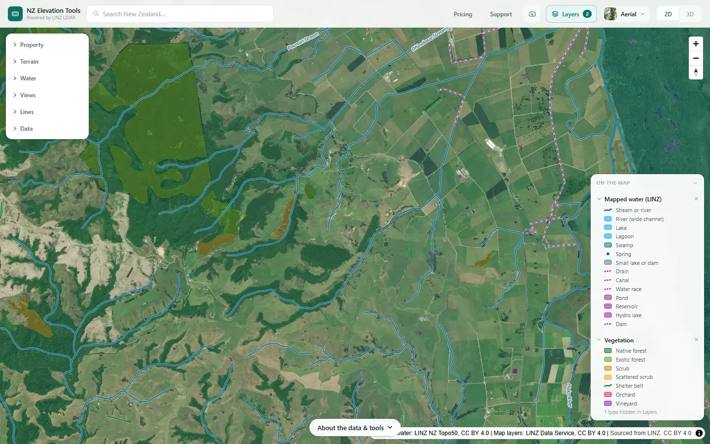
Find your place, with water and names on
Search the address and click the title. The link switches on Mapped water and Place names from the Layers menu, so the streams, drains and named features LINZ has mapped draw over the photo as you zoom in.
Trace the rain downhill
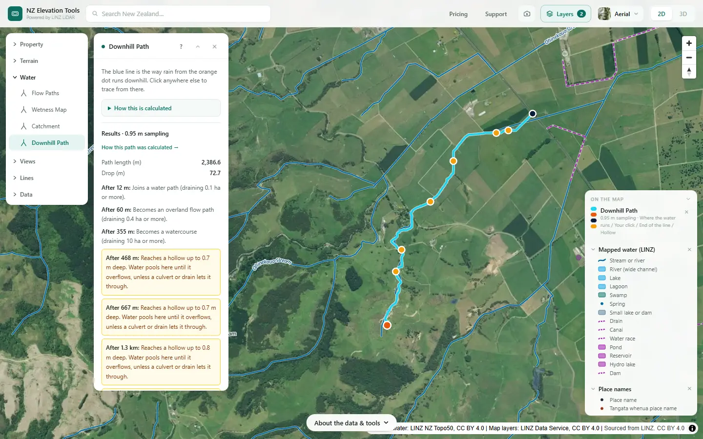
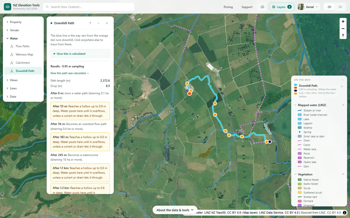
Click the house site, a paddock or the low corner of the block. Downhill Path follows the water over the LiDAR ground model and reports how far it runs before it joins a water path, becomes a watercourse and reaches a stream. Try a few spots: where the paths split, a ridge divides your land between catchments.
Name the stream it reaches
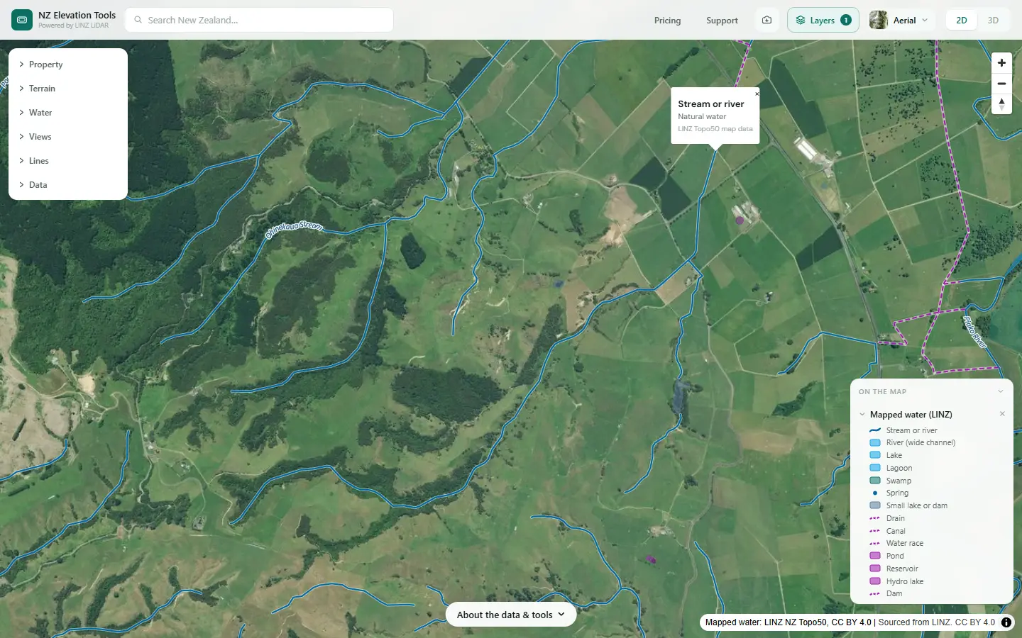
Where the path meets the blue line of a mapped stream, click the stream for its kind and, where LINZ has one, its name. Follow it downstream on the map to the river it joins. That chain, your stream into its river into the next, is your catchment address.
Map your sub-catchment
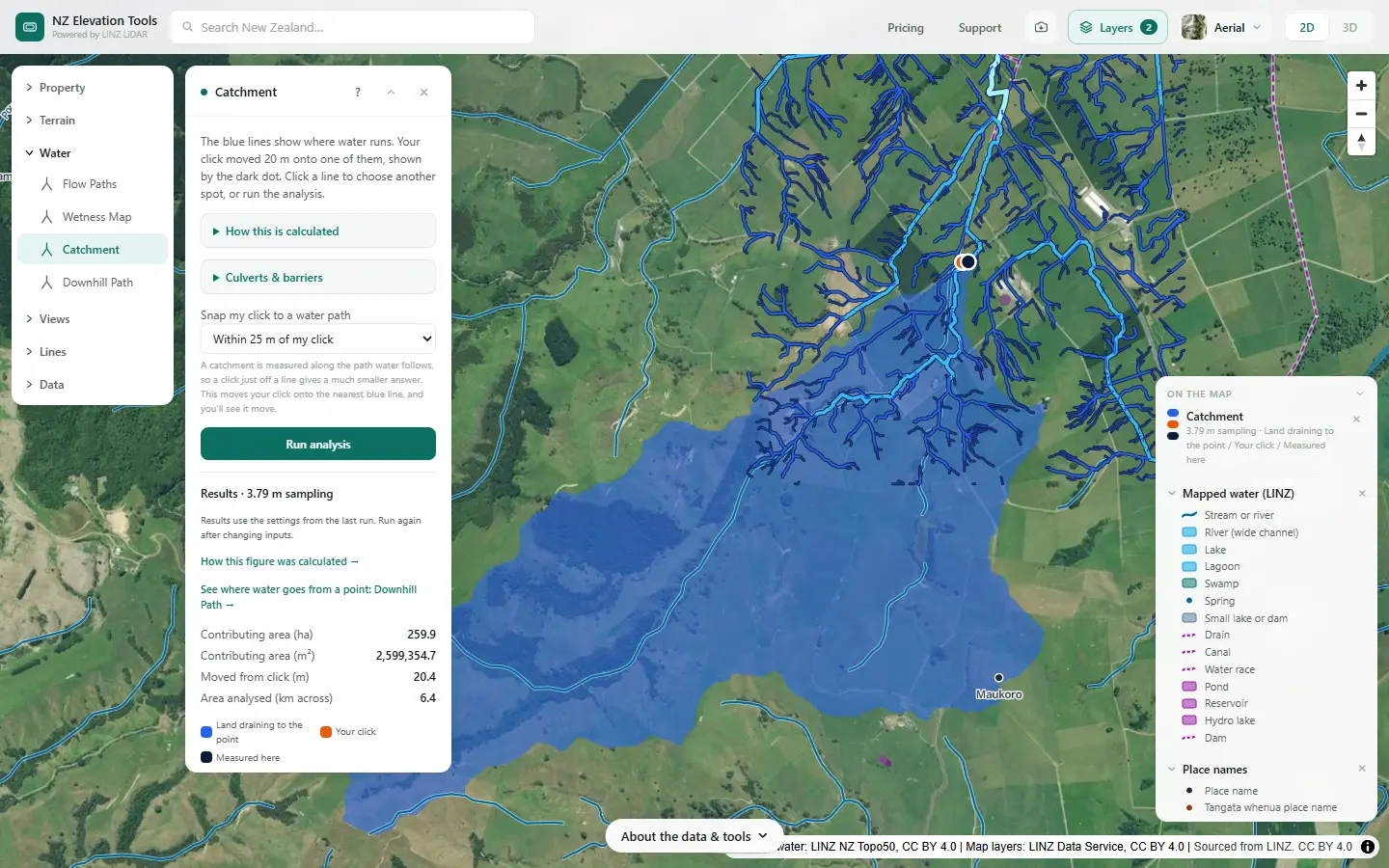
Click your stream just below where it leaves your land. Catchment maps all the land draining to that point, in hectares, and outlines it. That is the sub-catchment your farm sits in: your land, and everyone upstream who shares the stream with you.
See what is upstream
With the outline in mind, look over the land inside it: bush, pasture, crop, town. Aerial History steps back through the LINZ photos to show what it was before, back to the 1930s in places, and Vegetation in the Layers menu draws the mapped forest and scrub.
Get the council’s catchment context
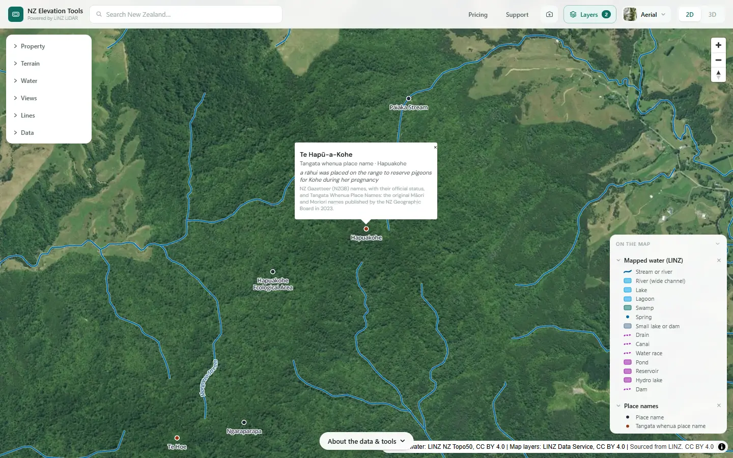
Your regional council names its catchments and freshwater management units and publishes what it knows about each: water quality, values, sites of significance. LAWA shows the monitoring sites near you. Place names adds the gazetteer names and Tangata Whenua Place Names, with their kōrero.
What it adds up to on this farm
Rain on the hill paddocks runs down the gullies into the farm’s stream, which leaves the farm across the flats with 260 ha draining to it. The streams here run out across the flats towards the Piako River. Rain beside the dairy shed, a few hundred metres away, takes a different route: Downhill Path sends it east over the flats to the drains by the Piako, not into the farm’s own stream. One farm, two routes to the same river.
That is the answer to quote to a catchment group: the farm’s own sub-catchment of about 260 ha, part of the land draining to the Piako. The council’s maps name the Piako catchment and its management units.
Keep going with the water
Once you know where your water goes, the next questions are what it crosses on the way and where it gathers. Saving the map as an image is free; the catchment outline exports as DXF, GeoJSON or KML with a pass.
What this cannot tell you
- The whole of a big river’s catchment. Catchment reaches up to 5 km from your click and says so when the land draining to the point runs further. Use your council’s maps for the big picture.
- The council’s names and boundaries. Councils draw their own catchment and freshwater management unit boundaries, sometimes joining several catchments. Ask them which one your farm is in.
- Where drains and pipes send the water. Tile drains, culverts and stormwater pipes are not in the ground model, so on flat or drained land water can go somewhere the terrain does not show. Draw the culverts and drains you know about in the water tools.
- Groundwater. Water that soaks in can travel under the surface to a different stream, or to a spring kilometres away. Surface catchments are a starting point, not the whole story.
- Every stream’s name. Names on the map come from a LINZ pilot that named only part of the network, and they are unofficial.
Related guides
- Catchment area for a culvert or crossing — the same tool, for sizing a pipe.
- Natural or artificial? — streams, drains and ponds on a farm map.
- How to divide your farm into land units — the next step in a farm plan.
- The traditional name of your stream or river — Tangata Whenua Place Names on the map.
- Map layers — the streams, drains and names LINZ has mapped.
Screenshots from NZ Elevation Tools of a dairy and drystock farm on the edge of the Piako flats in the Waikato, with legal descriptions and owners blurred. Aerial photos and LiDAR from LINZ. Sourced from the LINZ Data Service and licensed by Regional Software Holdings Limited and Waikato Regional Council for re-use under the Creative Commons Attribution 4.0 International licence.
Frequently asked questions
What is a catchment?
All the land whose rain ends up in the same stream, river or lake. Its edge is the ridgeline where water starts running the other way. Every point on a stream has its own catchment: everything uphill of it that drains to it.
What is a sub-catchment?
A catchment inside a bigger one. The land draining to a creek is a sub-catchment of the river the creek joins, which may be a sub-catchment of a larger river again. When a council or a catchment group talks about your sub-catchment, they usually mean the land draining to your local stream, often a few hundred to a few thousand hectares.
How do I find out which catchment my property is in?
Follow the water. Trace the rain from your land downhill to the first stream, note which river that stream joins, and keep going until you reach a river your regional council names. Downhill Path does the first part from the LiDAR ground model, and the Mapped water layer names the streams LINZ has named.
Can my property be in more than one catchment?
Yes, often. If a ridge crosses the farm, rain on one side goes to one stream and rain on the other side to another. Run Downhill Path from a few spots either side of the high ground and the paths will split.
How big a catchment can the tool map?
Catchment reaches up to 5 km from the point you click, so it maps the sub-catchment around a farm or a stream reach. It does not map the whole catchment of a large river. For that, your regional council publishes its own catchment and freshwater management unit maps.
Why does my stream have no name?
Many small streams were never named, and the names on the map come from a LINZ pilot that named only part of the river network. Names from it are unofficial. Place names, in the Layers menu, adds official gazetteer names and Tangata Whenua Place Names where they exist.