The Traditional Name of Your Stream or River
The streams, rivers and ranges around your farm had names long before the topographic map. Many of them, and the stories behind them, are now published and on the map.
A freshwater farm plan looks at the farm as part of its catchment, and the catchment context it draws on includes “the traditional name(s) of freshwater bodies”, along with sites and species significant to tangata whenua (MfE, Developing a freshwater farm plan, section 3.2). Knowing the name of the river your water reaches, and what it means, is a good place to start.
In 2023 the New Zealand Geographic Board Ngā Pou Taunaha o Aotearoa published Tangata Whenua Place Names: original Māori and Moriori names, many with a kōrero. The Place names layer shows them on the map, with the official gazetteer names.
See the names around your place
Switch on Place names and zoom in. Red dots are Tangata Whenua Place Names; click one for its kōrero. Free to use, no login.
Show place names →Find them in four steps
Shown around the example farm used in the other farm guides, below the Hapuakohe Range on the edge of the Piako flats in the Waikato.
Switch on Place names
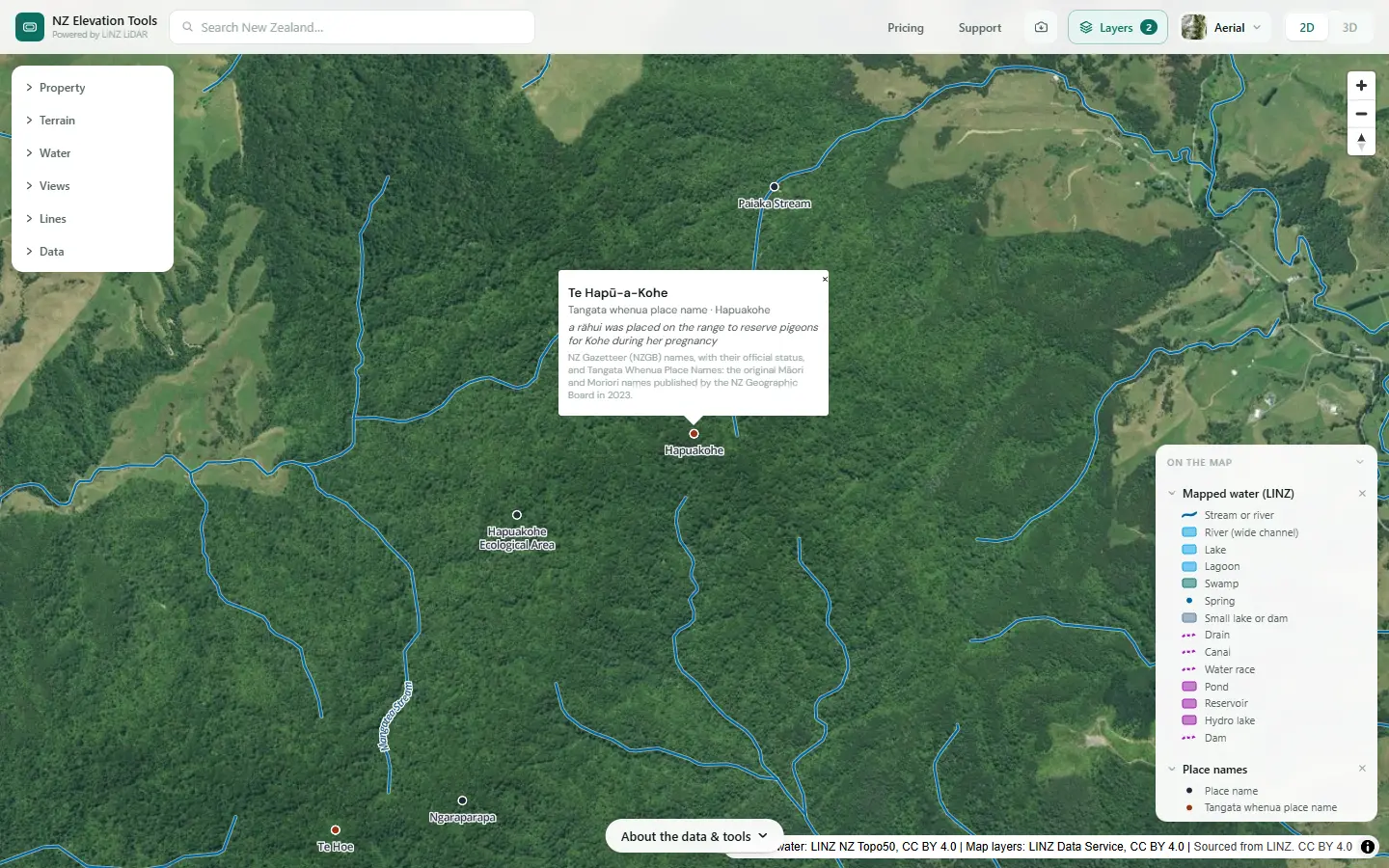
Turn on Place names in the Layers menu, with Mapped water. Official gazetteer names show as dark dots; Tangata Whenua Place Names show as red dots, with their names in italics.
Click a red dot for its kōrero
Each Tangata Whenua Place Name opens to the name, the current name or description it relates to, and the kōrero published with it. For Te Hapū-a-Kohe: a rāhui was placed on the range to reserve pigeons for Kohe during her pregnancy.
Click a name →Follow your streams to the named places
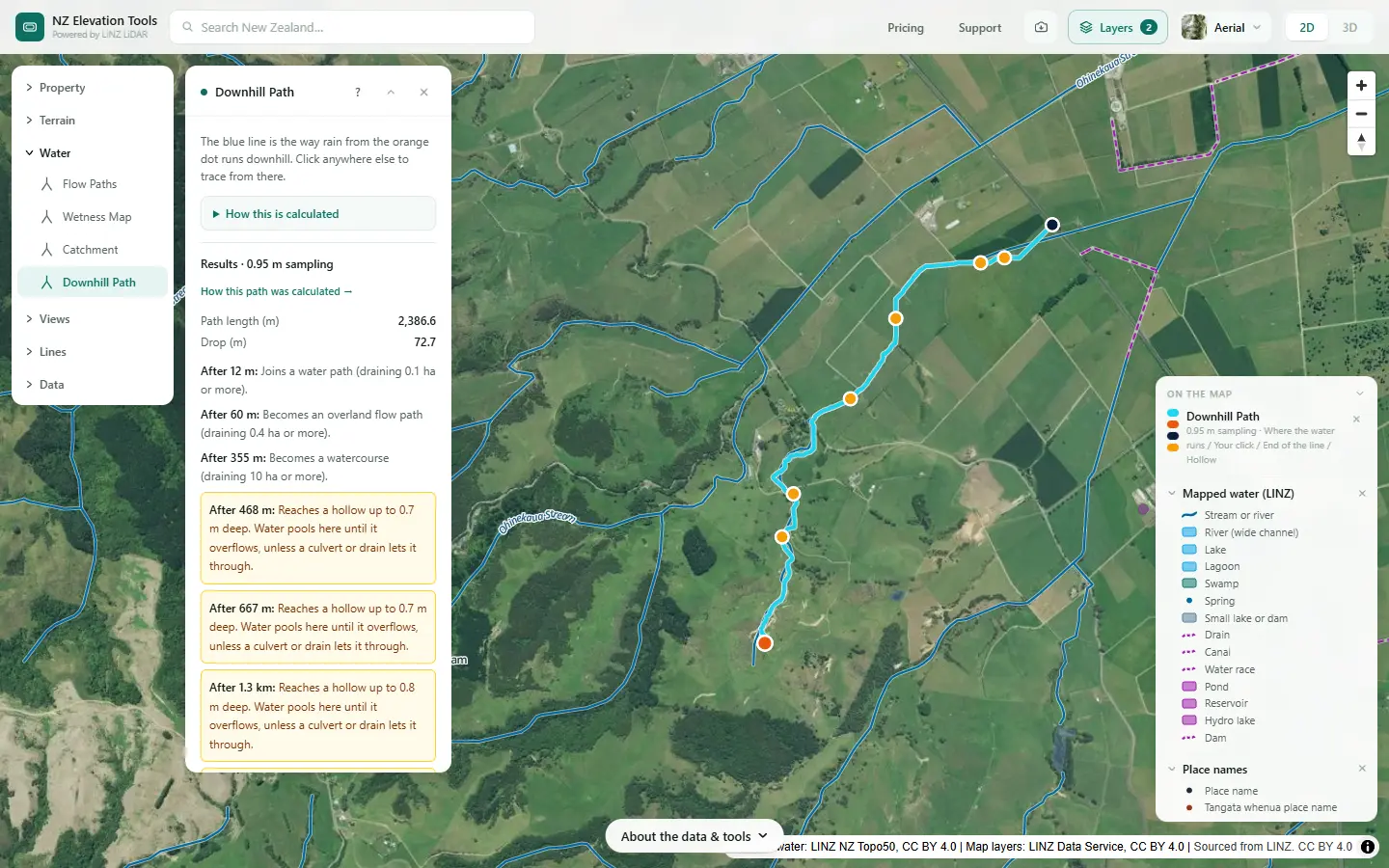
Trace your water downhill and follow the stream to the river it joins. The traditional names are often on the larger rivers, ranges and settlements your water passes. Around the example farm they include Te Hapū-a-Kohe, the range to the west, Piako, the river the plains drain to, and Tāhuna, a kāinga nearby.
Ask the council and mana whenua
The farm plan guidance asks for the traditional names of freshwater bodies, significant sites and species, and matters of importance to tangata whenua, as part of catchment context. Your regional council holds what it has gathered with iwi and hapū, and can tell you who to talk to.
Keep the map open →Put it in the catchment context
Saving the map as an image is free, with the LINZ credit stamped on it.
What this cannot tell you
- Every name. The published set is a start, not a complete record. Many names are held by mana whenua and not published.
- The full meaning. A published kōrero is a sentence or two. The history behind it belongs to the iwi and hapū who hold it.
- Cultural values and sites. Those come from mana whenua and the council’s catchment context, not from a map layer.
Related guides
- What catchment am I in?
- Farm maps for a freshwater farm plan
- Map layers: streams, drains and farm features
Screenshots from NZ Elevation Tools of a dairy and drystock farm on the edge of the Piako flats in the Waikato, with legal descriptions and owners blurred. Aerial photos and LiDAR from LINZ. Sourced from the LINZ Data Service and licensed by Regional Software Holdings Limited and Waikato Regional Council for re-use under the Creative Commons Attribution 4.0 International licence. Place names from the NZ Gazetteer and Tangata Whenua Place Names (NZ Geographic Board Ngā Pou Taunaha o Aotearoa, 2023), via the LINZ Data Service, CC BY 4.0.
Frequently asked questions
Where do the traditional names on the map come from?
From Tangata Whenua Place Names, published by the New Zealand Geographic Board Ngā Pou Taunaha o Aotearoa in 2023: original Māori and Moriori names gathered with iwi and hapū, many with a short kōrero about the name. The map also shows official names from the NZ Gazetteer.
Why is there no traditional name for my stream?
The published set is not complete, and many waterways have names held by mana whenua that have never been published. A gap on the map does not mean there is no name.
Who should I talk to about cultural values for my farm plan?
The iwi and hapū of your area. Your regional council can tell you who they are, and the council’s catchment context information may already include cultural values, significant sites and traditional names identified with them.
Can I use the names in my farm plan?
The published names and kōrero are there to be used and learned. Quote them as published, with where they came from, and check with mana whenua before writing more about a place than the published kōrero says.