Earthworks and civil site planning from New Zealand LiDAR
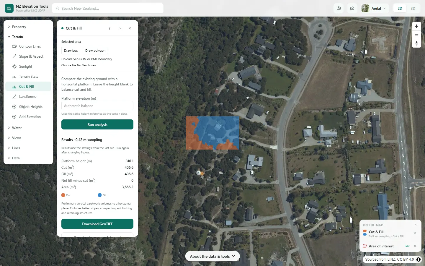
Price and plan earthworks on any New Zealand site from the LINZ 1 m LiDAR ground model, before anyone walks it with a level. Draw a building platform and get cut and fill volumes and the height that balances them. Pull 0.5 m contours into CAD as DXF. Check the driveway gradient, and measure the catchment draining to the culvert.
It is the desktop step before the survey and the machine: enough to quote a job, spot the site that will blow the budget, and give the designer a terrain model on day one.
The workflow
Step 1 · Property
Load the title boundary
The legal parcel as the working area, so everything after is clipped to it.
Step 2 · Contour Lines
Site contours for design
Contours from 0.5 m, previewed on the map and exported as DXF for AutoCAD or Civil 3D.
Step 3 · Cut & Fill
Size the platform earthworks
Cut and fill in m³ at a level you set, or the level where they balance, and a cut/fill depth map.
Step 4 · Elevation Profile
Check access gradients
The grade along a driveway or haul road, section by section, and the total climb.
Step 5 · Catchment
Culvert and stormwater catchments
The upstream area draining to a culvert or low point, in hectares, as the first input to sizing.
Step 6 · Water & Drainage
Overland flow across the site
Where water runs and ponds across the site, so the pad and the swales go in the right place.
Free to run · pay to download
See the full result on the map free, with no account. Download contours as DXF, the elevation model and cut/fill and catchment grids as GeoTIFF, and drainage channels as GeoJSON or KML with a pass: NZ$49 for 7 days or NZ$299 for 12 months, one-off, GST included, not a subscription. Every download on the site is included while the pass lasts.
What it doesn’t replace
- Volumes are bank cubic metres to a flat plane: no batters, topsoil strip, bulking, compaction or retaining. Real quantities run higher.
- The ground is as the LiDAR recorded it. Scrub, recent earthworks and buildings since the capture date are not reflected.
- Culverts, pipes and stopbanks are not in the terrain, so catchments and flow paths route over roads and through embankments.
- Consent drawings and contract quantities still need a topographic survey by a licensed surveyor.
Questions
How accurate are LiDAR earthworks volumes?
As good as the LiDAR survey for the area and its date. On open ground the model follows the real surface closely, which makes it good for estimating and comparing options. Under dense vegetation, or on ground worked since the capture, it is not. Check the result against the site before relying on it.
Do I need resource consent for my earthworks?
It depends on your district plan. Councils set earthworks thresholds by volume, area and sometimes cut depth, and they differ between councils and zones. Use the volumes here to see how close a job is to your council's thresholds, then check the plan rules.
Can I get the contours into Civil 3D?
Yes. Contours export as DXF with each line at its height, which Civil 3D and AutoCAD read directly. The elevation model itself exports as a GeoTIFF for building a surface.
Can a whole crew use one pass?
A pass lives in the browser it was bought in, with no account. Anyone can run the tools free; downloads work in the browser holding the pass.
Guides
Data
Everything runs on the LINZ national 1 m LiDAR bare-earth elevation model, read in your browser, with the national 8 m model filling any gaps. Every result says how much of the area came from that fallback.
Elevation and cadastral data is sourced from the LINZ Data Service and licensed for re-use under the Creative Commons Attribution 4.0 International licence. Copyright in each LiDAR survey belongs to the body that commissioned it — a regional or district council, Waka Kotahi, NIWA and around thirty others — rather than to LINZ, which hosts and processes the national dataset. Every file exported from this site names the licensors whose surveys cover the area, and anything you publish from those files carries the same attribution requirement. See https://www.linz.govt.nz/products-services/data/licensing-and-using-data/attributing-elevation-or-aerial-imagery-data Sample image: Sourced from the LINZ Data Service and licensed by Environment Southland, Otago Regional Council and Queenstown-Lakes District Council for re-use under the Creative Commons Attribution 4.0 International licence.