Natural or Artificial? Streams, Drains and Ponds on a Farm Map
Which waterways on your farm are streams, and which are drains someone dug? A farm plan maps them separately, and the map is a starting point, not the answer. Here is how to check it, on a real farm.
A freshwater farm plan asks for maps of the farm’s surface freshwater bodies and, as a separate item, its artificial freshwater bodies (MfE, Developing a freshwater farm plan). Natural water is the streams, rivers, lakes, lagoons, swamps and springs. Artificial water is what people made: drains, canals, water races, dams and ponds. They are split because they behave differently, carry different risks and are often under different rules.
Most of it is easy to tell apart. The hard cases are the straight drain that used to be a creek, the farm dam LINZ mapped as a lake, the swamp nobody mapped, and the mapped line that is not where the water is.
What the law counts as a river
The Resource Management Act defines a river as “a continually or intermittently flowing body of fresh water; and includes a stream and modified watercourse; but does not include any artificial watercourse (including an irrigation canal, water supply race, canal for the supply of water for electricity power generation, and farm drainage canal)” (RMA, section 2).
The words that matter on a farm are modified watercourse. A stream that has been straightened, deepened or moved is still a river. A drain dug where no stream ran is an artificial watercourse. Which one a particular drain is, your regional council decides, and rules for each differ between regions. This guide does not decide it for you. It shows you how to gather the evidence.
How the map sorts them
The Mapped water layer draws the water LINZ mapped on its 1:50,000 topographic map, NZ Topo50, in three groups:
- Natural: stream or river, river (wide channel), lake, lagoon, swamp, spring.
- Artificial: drain, canal, water race, pond, reservoir, hydro lake, dam. Lakes LINZ records as reservoirs or hydro lakes are counted here.
- Unclear: small lake or dam. Lakes under 2 ha, because LINZ maps many farm dams as lakes.
That is LINZ’s mapping, not a legal ruling. A drain on the map may be a modified stream, a lot of real drains, dams and ponds are too small to have been mapped, and a line drawn at 1:50,000 can sit well off the real channel.
See the water on your farm
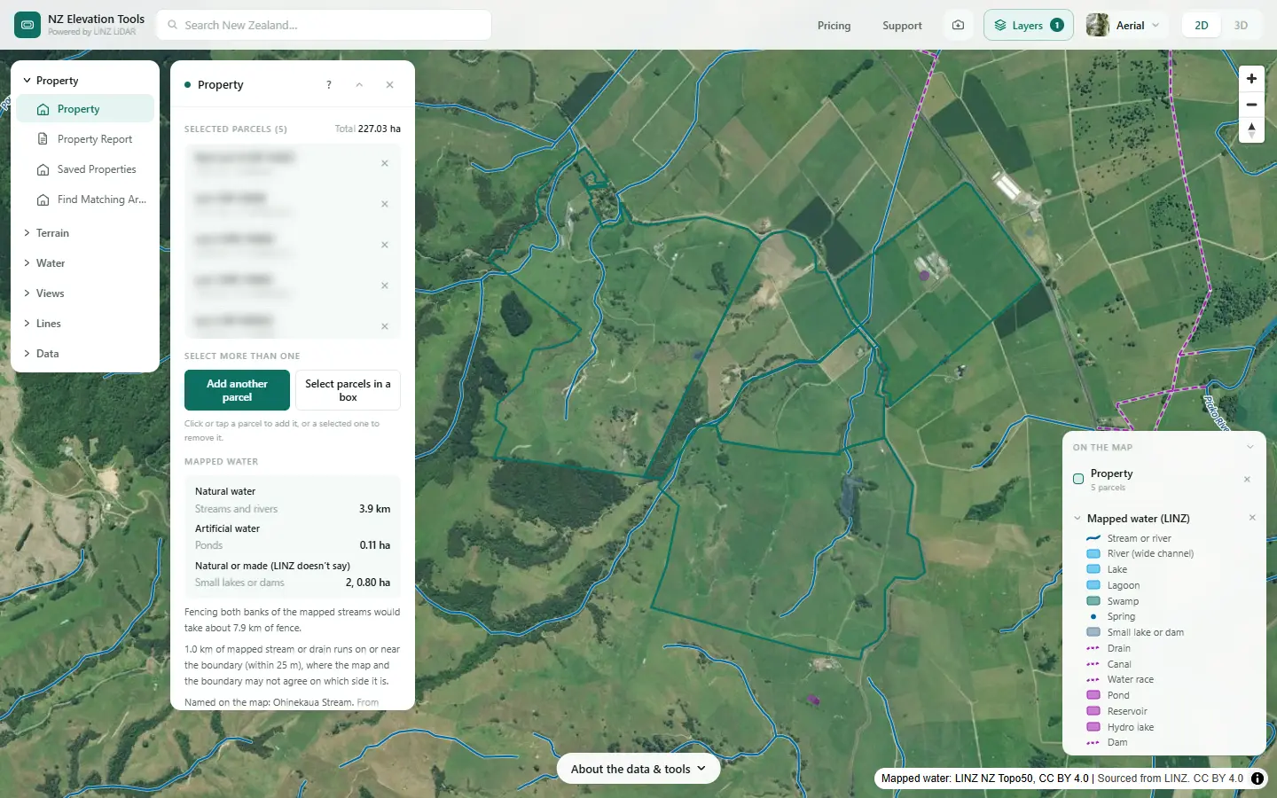
Click the title and the Property panel lists the mapped streams, lakes and swamps apart from the drains and ponds, with lengths, areas and the fence to fence both banks. Free to use, no login.
Open Property with water on →Check them in six steps
The example is a dairy and drystock farm on the edge of the Piako flats in the Waikato. The numbers are what the tools gave on 19 November 2026.
Load the farm with Mapped water on
Search the address and click the title; turn on Add another parcel for the rest. The Property panel lists the mapped water inside the boundary: natural streams, rivers, lakes and swamps in one group, drains, canals and ponds in another, with the length or area of each kind.
Click each waterway
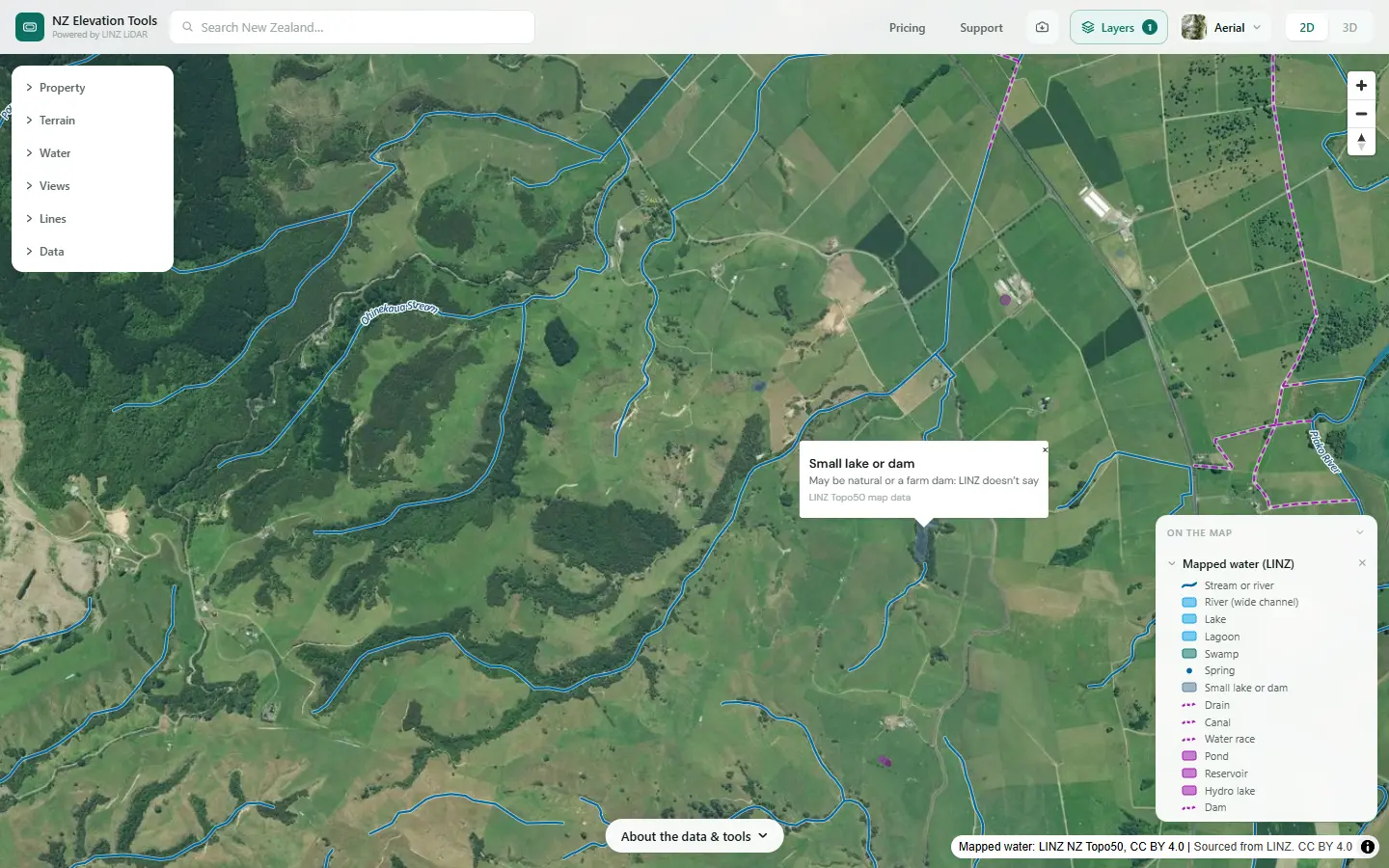
Clicking a line or area gives its kind and, where LINZ has one, its name. Natural water is drawn in blue (swamps in teal), artificial water in purple with the drains, canals and races dashed, and small lakes or dams in grey-blue. Filter and style in the Layers menu hides the kinds you do not need.
Check each line against the land
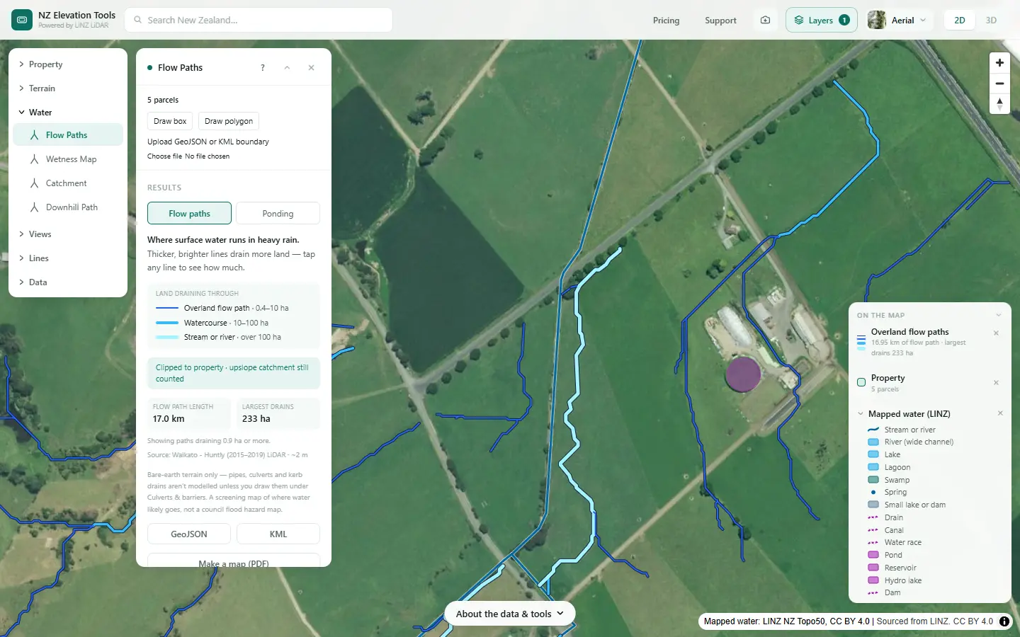
Run Flow Paths over the farm and zoom in. Where a mapped line and the LiDAR flow path agree, the map is right about where the water runs. Where they part, trust the LiDAR for position. A drain sitting on a big natural flow path is following where water would run anyway; one cut across the slope with little draining to it was more likely dug.
Look back at the old photos
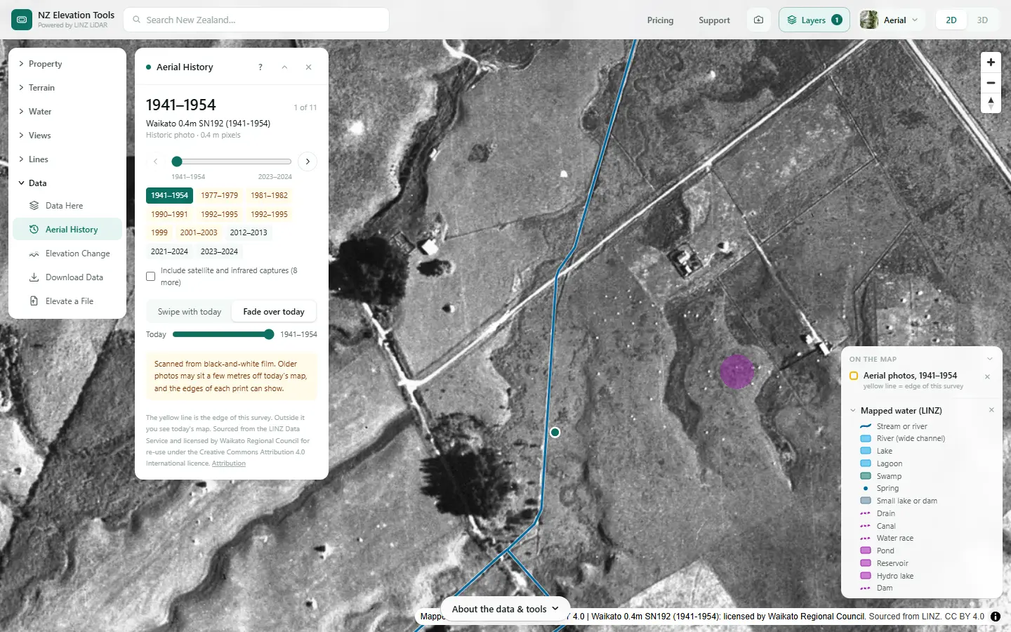
Click the waterway and step back to the oldest photo, then choose Fade over today. A winding channel or a line of willows under a straight drain means a stream was probably straightened. Bare paddock means the drain was probably dug. The same works for ponds and dams: watch for the year one appears.
Find the wet ground that is not mapped
Swamps and seeps are under-mapped. The Wetness Map ranks the land by how much the shape of the ground concentrates water, and the wettest flats and hollows are the places to check for a wetland in the paddock.
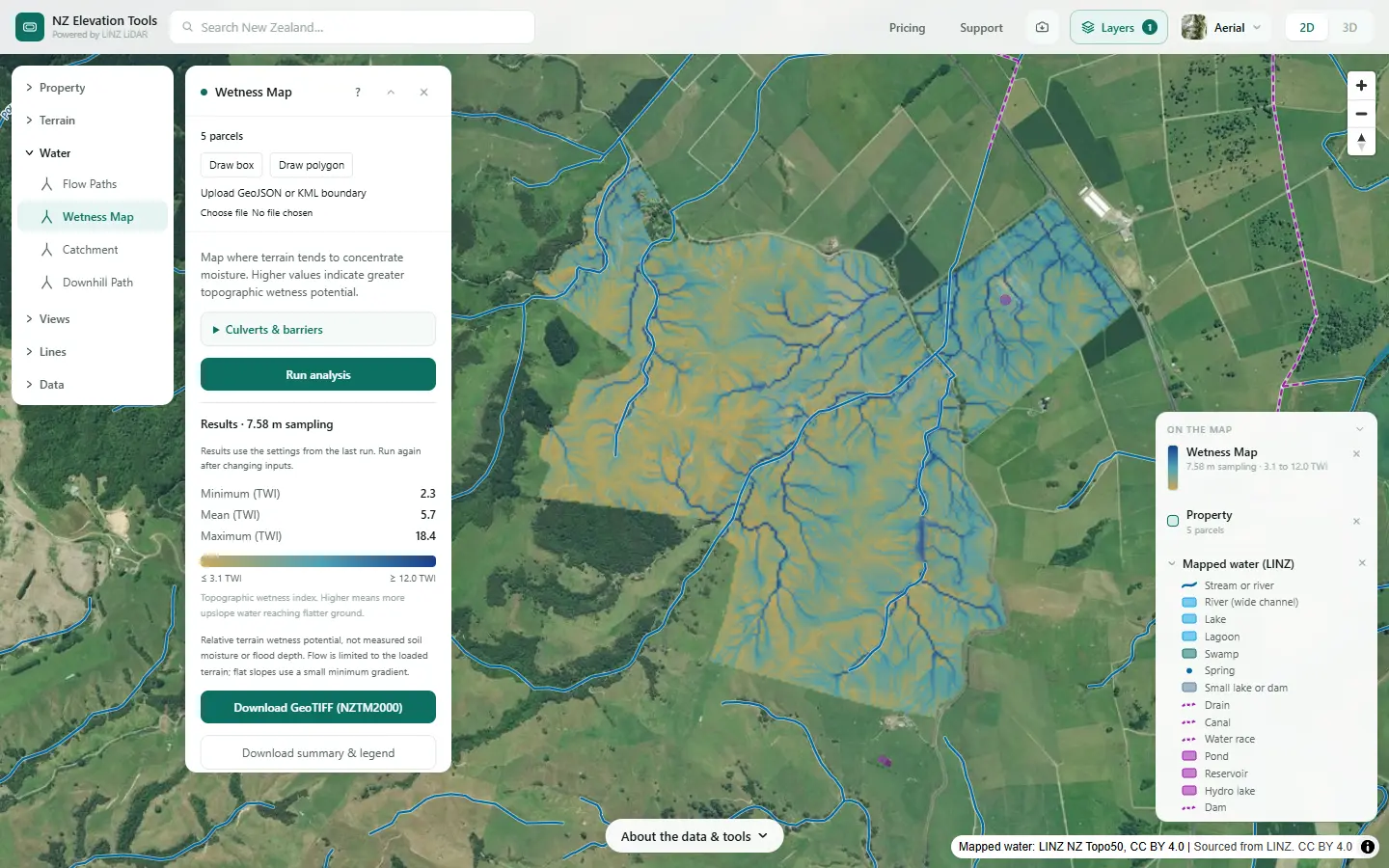
Mark up what the map missed
Walk the farm with the map on your phone. Note the drains, dams and springs that are not mapped, and the mapped ones that have moved or changed. Measure gives the length of a drain or the area of a pond you trace. Take the list, and the photos, to your adviser.
Measure →What it showed on this farm
The stream across the flats is mapped by LINZ as a natural stream, drawn as a straight line. A straight stream on flat dairy country raises two questions: was it dug or straightened, and is the line even where the water runs?
The second one the tools answer. The LiDAR flow path does not follow the straight line; it winds back and forth beside it, up to about 40 m away, which is the channel the ground model actually holds. Today’s photo shows nothing in particular on the straight mapped line itself.
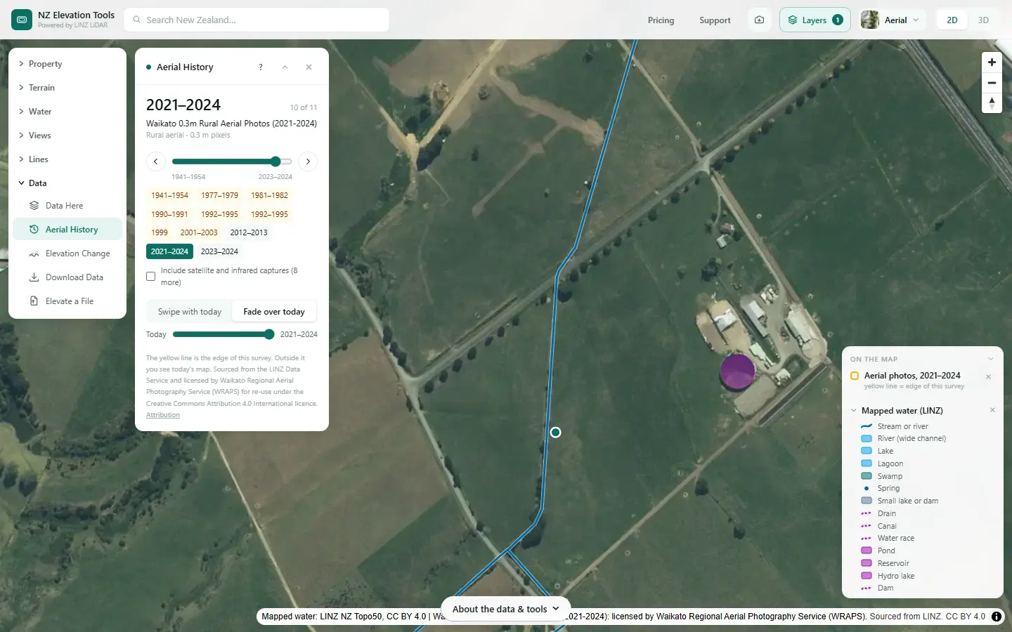
So a farm plan map drawn from the LINZ line would put this stream, and any fence or setback along it, up to 40 m out. Draw from the LiDAR line and walk it to confirm. The first question, whether the stream was ever straightened or moved, the old photos raise but do not settle here. That is one for the ground and the council.
Hand it to your adviser
Saving the map as an image is free. With a pass, the property data ZIP holds the mapped water as GeoJSON, KML with natural and artificial in separate folders, and DXF with a layer per kind, and Flow Paths exports the LiDAR lines as GeoJSON or KML.
What this cannot tell you
- What the law says about a particular drain. The council decides whether it is a modified watercourse, and what you may do to it.
- Every drain, dam and pond. The topographic map is 1:50,000. Most farm drains and small dams are not on it, and lines can sit well off the real channel.
- Whether a wet patch is a wetland. The Wetness Map shows where the land concentrates water. Whether a place is a natural wetland depends on its plants and soils, and has its own rules.
- Whether a stream flows all year. The map does not say which streams are permanent and which run only in winter.
Related guides
- What catchment am I in? — where your streams and drains end up.
- How to divide your farm into land units — drainage is one of the things that sets them.
- How much riparian fencing do I need? — measuring the streams to fence.
- Mapping farm drainage — drains, wet ground and where water ponds.
Screenshots from NZ Elevation Tools of a dairy and drystock farm on the edge of the Piako flats in the Waikato, with legal descriptions and owners blurred. Aerial photos and LiDAR from LINZ. Sourced from the LINZ Data Service and licensed by Regional Software Holdings Limited and Waikato Regional Council for re-use under the Creative Commons Attribution 4.0 International licence.
Frequently asked questions
What is the difference between a natural and an artificial water body?
A natural one formed on its own: a stream, river, lake, lagoon, swamp or spring. An artificial one was made: a farm drain dug through dry ground, an irrigation canal, a water race, a dam or a pond. A freshwater farm plan maps the two separately because they carry different risks and often different rules.
Is my drain legally a stream?
It might be. The Resource Management Act counts a modified watercourse as a river, so a stream that has been straightened or deepened is still a river in law, while a drain dug where no stream ran is an artificial watercourse. Your regional council decides which a particular drain is. Old aerial photos and the shape of the land are good evidence to take to them.
Where does the map get natural and artificial from?
From how LINZ mapped each feature on the 1:50,000 topographic map, NZ Topo50. Streams, lakes and swamps are one set of layers; drains, canals, races, ponds and reservoirs are another. Lakes LINZ records as reservoirs or hydro lakes are counted as artificial.
Why is my pond shown as a small lake or dam?
LINZ maps many farm dams as lakes. Lakes under 2 ha are listed as "small lake or dam" because the map cannot say whether one is natural or made. Aerial History usually settles it: a dam appears in the photos after a certain year, often with a straight embankment.
Why is a mapped stream in the wrong place?
The topographic map was drawn at 1:50,000, so lines are simplified and can sit tens of metres off the real channel on flat ground. Flow Paths traces where water runs on the LiDAR ground model, metre by metre, and is usually the better guide to where the channel really is.
Can I give the water map to my adviser?
Yes. The mapped water inside a property is part of the property data ZIP, as GeoJSON, KML for Google Earth with natural and artificial in separate folders, and DXF with one layer per kind for CAD. The download needs a pass; looking is free.