Data · Click a point
Historical aerial photos of any NZ property, then and now
See historical aerial photos of any property in New Zealand: click the map and step through every LINZ aerial photo survey that covers the spot, oldest first, from black-and-white scans as early as 1938 in the Waikato to this year’s imagery.
Drag a divider across the map to compare any year with today, or fade the old photo over the current one. Each photo is credited to the council or agency that licensed it.
Free to run · pay to download
Free to run, and free to save as a PNG image of the map. This tool has no file export of its own. For the terrain as a file, Download Data exports contours, a GeoTIFF or a 3D mesh with a pass: NZ$49 for 7 days or NZ$299 for 12 months.
Who uses this
- Buyers and owners. See what was there before the house: old slips, filled gullies, streams, orchards or buildings since removed.
- Planners and consultants. Check past land use for a site investigation before ordering archive prints.
- Family and local historians. Find the farm, street or beach as it looked decades ago.
When to use it
- You want to know what a property looked like before it was subdivided, built on or planted.
- You are looking for old slips, filled gullies, buried streams or demolished buildings.
- You want to see how a river, beach or coastline has moved over the decades.
Which tool for your job
Aerial History is one step in a bigger question. These are the jobs it helps with, and the tools that go with it.
If you’re working on buying a section or lifestyle block
What is the ground like, and how does it compare with the others on my list?
- 1.Property — Selects the legal parcel so every other tool is clipped to the boundary.
- 2.Property Report — A PDF with contours, slope, aspect, winter sun, drainage, elevation and old aerial photos for that parcel, or several selected together.
- 3.Saved Properties — Up to five places side by side: elevation, slope, winter sun and drainage.
- 4.Flow Paths — Where water will run and pond across the block in heavy rain.
- 5.Aerial History (this tool) — Old aerial photos back to the 1930s in places: past slips, filled gullies and streams that have since gone.
- 6.Elevation Change — Where LiDAR was flown twice: whether the ground has slipped, been filled or been cut since.
How to use it
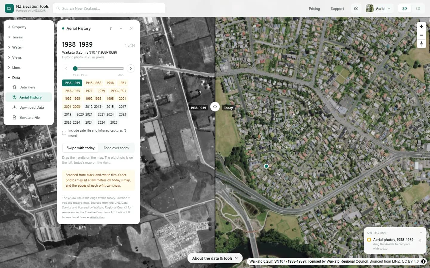
- Open Aerial History and click a spot. The oldest photo of it appears on the map, with today’s aerial on the right of a divider.
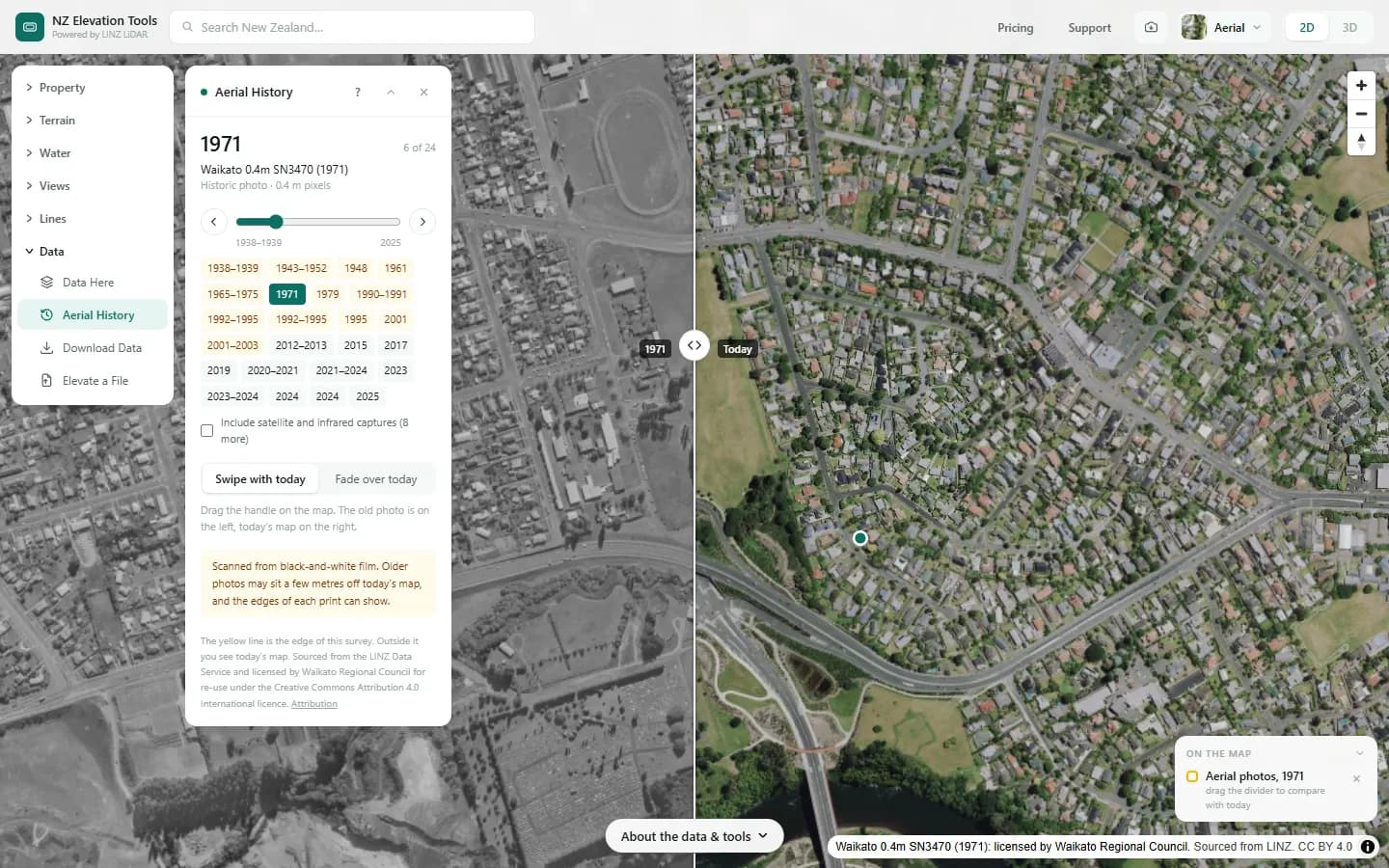
- Drag the divider handle across the map to compare. Use the slider, the arrows or the year buttons to move through the photos.
- Choose Fade over today to lay the photo over the whole map and set how see-through it is.
- Tick Include satellite and infrared captures to add the satellite images and false-colour surveys to the list.
Step by step: Mt Iron, Wānaka
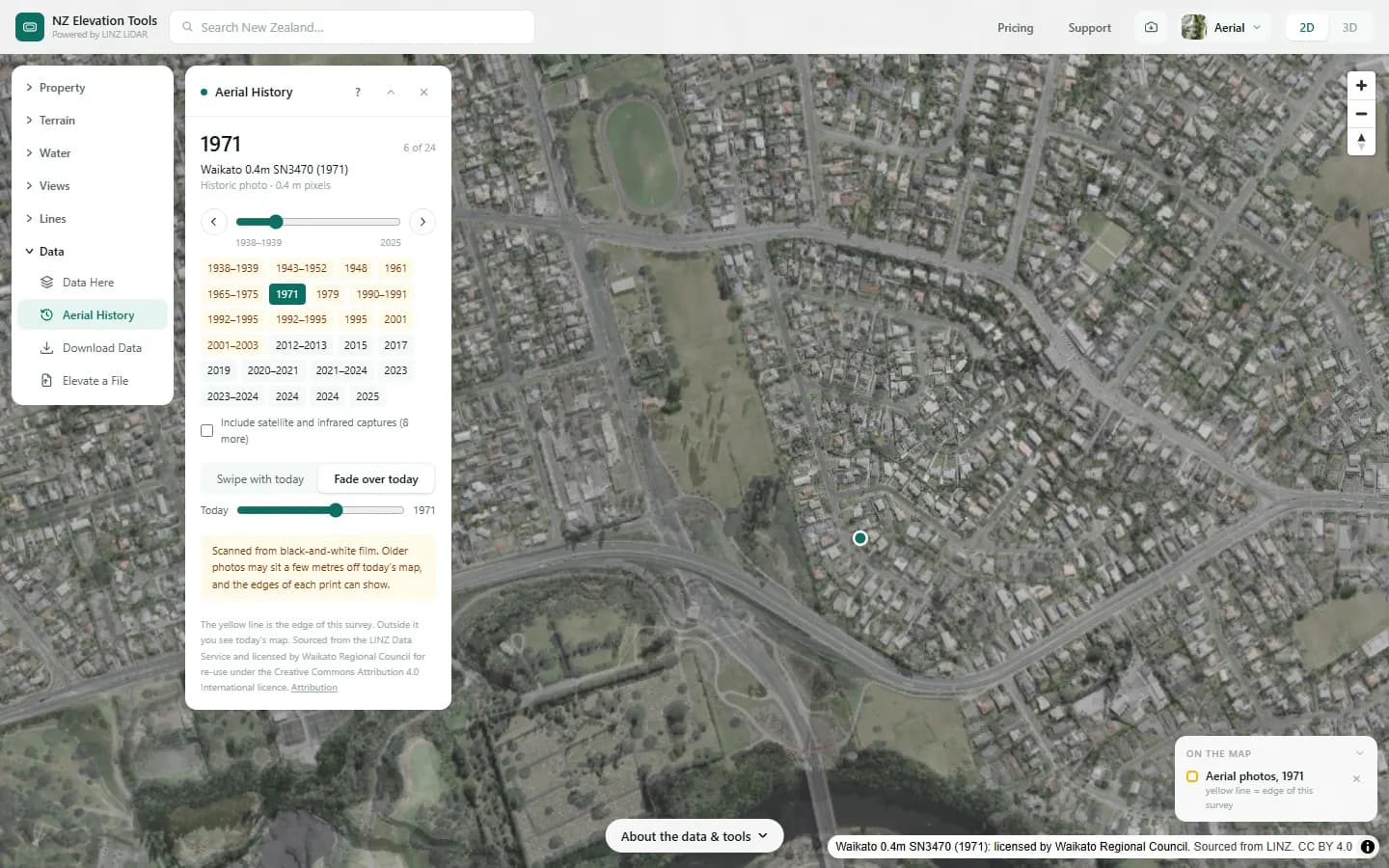
We look back at Hillcrest in Hamilton, which the Waikato’s oldest aerial survey caught as farmland in 1938–1939.
What it showed
- Old photos show what the ground was before it was built on: filled gullies, old stream lines, slips and buildings since removed.
- Photos before 1970 exist only in parts of the Waikato, Auckland and the Bay of Plenty so far.
Screenshots from NZ Elevation Tools. Aerial imagery from LINZ Basemaps. Sourced from the LINZ Data Service and licensed by Environment Southland, Otago Regional Council and Queenstown-Lakes District Council for re-use under the Creative Commons Attribution 4.0 International licence.
How it works
The photos are LINZ’s imagery surveys, served one survey at a time by LINZ Basemaps. The list of surveys covering the clicked point comes from LINZ’s imagery catalogue, which records where each survey was flown.
Historic photos are LINZ’s scans of black-and-white film from the national archive, corrected so they line up with the map.
Reading the results
Years are when the photos were taken. A range such as 2016–2018 means the survey was flown over several seasons, so neighbouring parts of the photo can be from different years.
The yellow line marks the edge of the survey. Outside it you see today’s map, not the old photo.
Historic scans are highlighted in the year list.
Limits and warnings
- Older scans can sit a few metres off today’s map, and the edges of individual prints sometimes show.
- Photos from before 1970 exist only in parts of the Waikato, Auckland and the Bay of Plenty so far. Elsewhere the scans LINZ has published start in the mid-1970s or 1980s.
- Looking is free. To keep a photo, Download Data cuts any of these surveys to an area as a GeoTIFF, a KMZ for Google Earth or a PNG with a world file; downloading needs a pass.
Data and attribution
The photos are LINZ’s aerial imagery surveys, served one survey at a time by LINZ Basemaps; the list of surveys at a point comes from LINZ’s imagery catalogue. No heights are read.
Elevation and cadastral data is sourced from the LINZ Data Service and licensed for re-use under the Creative Commons Attribution 4.0 International licence. Copyright in each LiDAR survey belongs to the body that commissioned it — a regional or district council, Waka Kotahi, NIWA and around thirty others — rather than to LINZ, which hosts and processes the national dataset. Every file exported from this site names the licensors whose surveys cover the area, and anything you publish from those files carries the same attribution requirement. See https://www.linz.govt.nz/products-services/data/licensing-and-using-data/attributing-elevation-or-aerial-imagery-data
Questions
How far back do the photos go?
It depends on the region. Parts of the Waikato go back to 1938, Auckland to 1939 and the Bay of Plenty to 1951. Elsewhere the photos LINZ has scanned so far start in the mid-1970s or 1980s. LINZ publishes more scanned surveys over time, and the list here is rebuilt from its catalogue.
Can I download the photos?
Yes, for an area, from Download Data: any of these photos as a GeoTIFF in NZTM2000, a KMZ for Google Earth or a PNG with a world file, credited to the licensor. Looking through them here is free; the download needs a pass.
Ready to try it?
Open Aerial History on the map →Free to use, no account. Runs in your browser on LINZ open data.
Missing something you need? Suggest a feature or ask about custom work.