Choosing a Winter Grazing Paddock: Slope, Swales and Distance to Water
Two paddocks can look the same from the gate and behave very differently under a winter crop. The shape of the land tells you which one sends soil to the stream.
Grazing a winter crop leaves bare, pugged soil through the wettest months, and whatever runs off that soil goes where the land sends it. A farm plan maps the potential areas of intensive winter grazing and the critical source areas inside them (MfE, Developing a freshwater farm plan, section 2.1). Picking the paddock is the biggest decision, and the terrain is most of it.
National and regional rules set limits on winter grazing, including slope and distance from water, and they have changed more than once. This guide gives no thresholds. Check the current ones with your council, then use the maps to see how each paddock measures up.
See the swales in each paddock
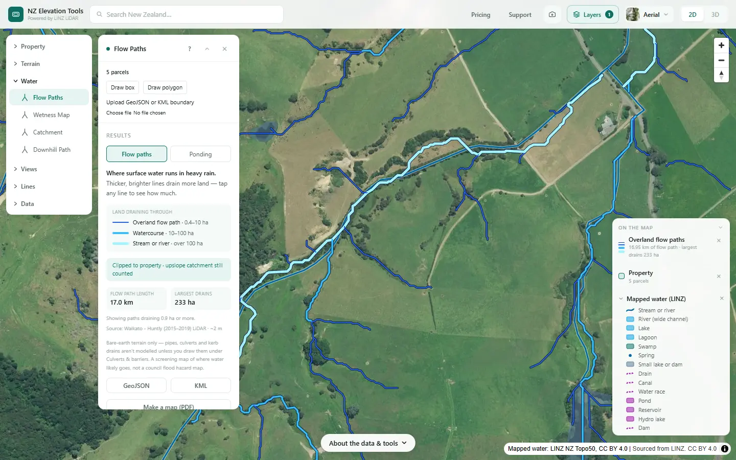
Select the farm and run Flow Paths. Tap any line to see how much land drains through it. Free to use, no login.
Open Flow Paths →Compare paddocks in five steps
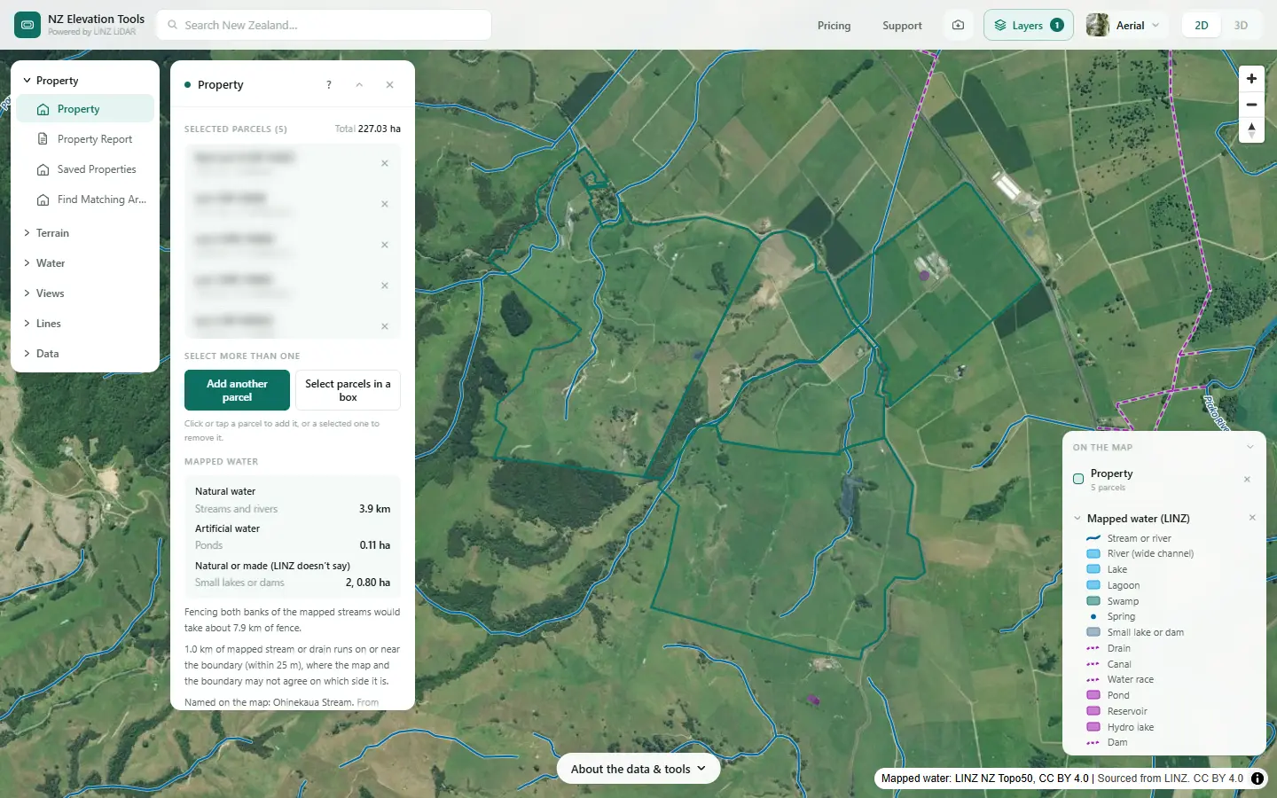
Shown on a dairy and drystock farm on the edge of the Piako flats in the Waikato, with the numbers the tools gave on 19 November 2026. The maps describe the land; they say nothing about where this farm grazes its crop.
Shortlist the paddocks
Select the farm. Note the paddocks you would consider for crop this winter, from the flats to the rolling country. Everything after this compares them on the shape of the land.
Find the swales that cross them
Run Flow Paths and zoom in on each candidate. A paddock with only short paths that die out on the flat sheds little to water. One with a swale running through it, joining a watercourse or the stream, has a critical source area to leave in grass, and a direct route to water.
Check the slope
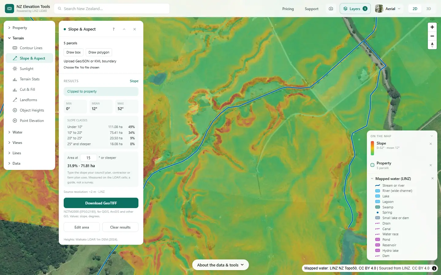
Run Slope & Aspect and look at each paddock. The panel gives the farm-wide classes; the map shows where in each paddock the ground steepens. Steeper ground runs off sooner and loses more soil when it is cultivated and grazed bare.
See where water would sit
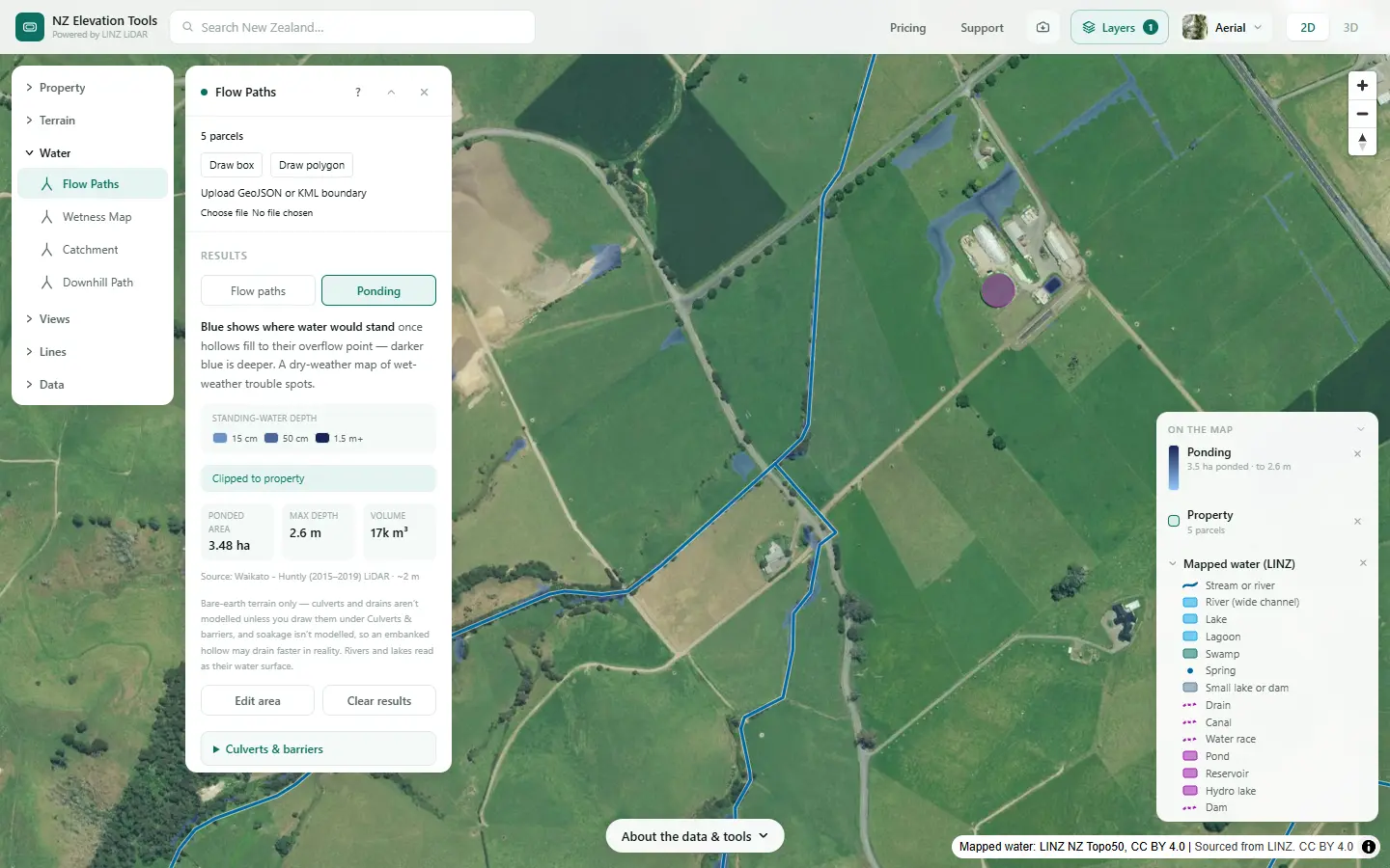
Switch to Ponding. Hollows that pond are where stock pug the soil and runoff drops what it carries. On flat paddocks the ponding view usually tells you more than the flow lines.
Follow the water from each paddock
Click the low corner of each candidate. Downhill Path shows where runoff goes and how far it travels before it becomes a watercourse and reaches a stream. A paddock whose water reaches the stream in a hundred metres is a different risk from one whose water spreads over flat pasture for a kilometre.
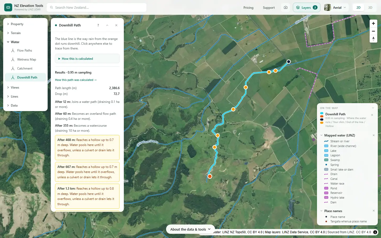
Reading it on this farm
The flats are gentle but have hollows that pond. The rolling paddocks are mostly gentle on top, with steep banks into the gullies and watercourses running through some of them. On maps alone, the rolling paddocks with no watercourse through them, and the flat paddocks away from the ponding hollows, look like the lower-risk ground. A walk after rain, the soil map and the current rules would settle it.
Put it in the plan
Saving the maps as images is free. With a pass, flow paths export as GeoJSON or KML and the slope grid as GeoTIFF, for the farm plan map.
What this cannot tell you
- The rules this winter. Slope limits, setbacks and consent requirements come from your council and national regulations.
- Your soil. Heavy soils pug and run off; free-draining ones leach. Check S-map.
- The drains. Tile drains under a crop paddock are a fast route to water the terrain does not show.
- How wet this winter will be. The maps show where water goes, not how much rain falls.
Related guides
- Critical source areas: map them on your farm
- How to divide your farm into land units
- Mapping farm drainage
- Farm maps for a freshwater farm plan
Screenshots from NZ Elevation Tools of a dairy and drystock farm on the edge of the Piako flats in the Waikato, with legal descriptions and owners blurred. Aerial photos and LiDAR from LINZ. Sourced from the LINZ Data Service and licensed by Regional Software Holdings Limited and Waikato Regional Council for re-use under the Creative Commons Attribution 4.0 International licence.
Frequently asked questions
What makes a good winter grazing paddock?
From the land’s point of view: gentle slope, no swale or gully running through it that carries water to a stream, well away from waterways, not a hollow where water sits, and soil that drains without pugging badly. Shelter, access and the crop itself matter too, but the terrain decides how much soil and nutrient can leave.
What are the rules for intensive winter grazing?
National regulations and regional rules set limits on things like slope, distance from waterways and how critical source areas are managed, and they have been rewritten more than once. Ask your regional council or adviser what applies this winter before you rely on a number.
What is a critical source area in a winter crop paddock?
A swale, gully or hollow in the paddock where runoff gathers and can carry soil, nutrients and dung to water. The usual practice is to leave it in grass, uncultivated and ungrazed, as a buffer. Flow Paths shows where they are and how much land drains through each.
How do I measure how steep a paddock is?
Select the paddock, or draw a box around it, and run Slope & Aspect. The panel gives the share of the area in each slope class, and you can type any slope to see how much is at least that steep. The map shows where in the paddock the steep bits are.