Stream Crossings and Farm Tracks on Your Farm Plan Map
Every place a track meets water is on the farm plan map, and every one has a number that matters: how much land drains through it.
A freshwater farm plan maps the farm’s freshwater crossings, “including formed crossings, such as bridges, culverts, and fords, and unformed crossings”, and its farm accessways: roads, tracks, races and underpasses (MfE, Developing a freshwater farm plan, section 2.2). Crossings are where stock meet water and where culverts wash out; tracks are where runoff starts early.
Measure the land draining to a crossing
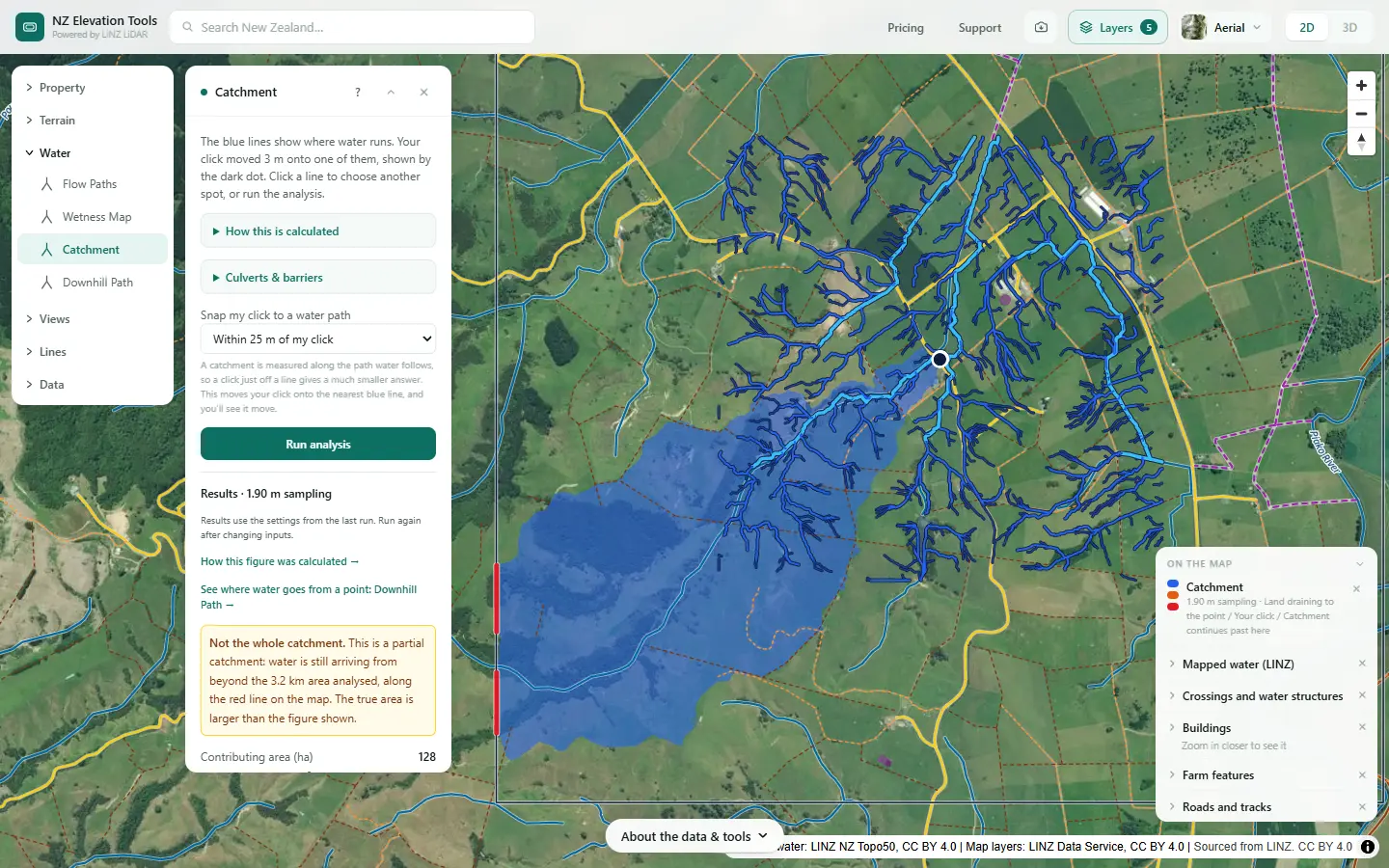
Open Catchment and click the stream where your track crosses it. Free to use, no login.
Open Catchment →Map them in five steps
Shown on a dairy and drystock farm on the edge of the Piako flats in the Waikato, with the numbers the tools gave on 19 November 2026.
Switch on the mapped crossings and tracks
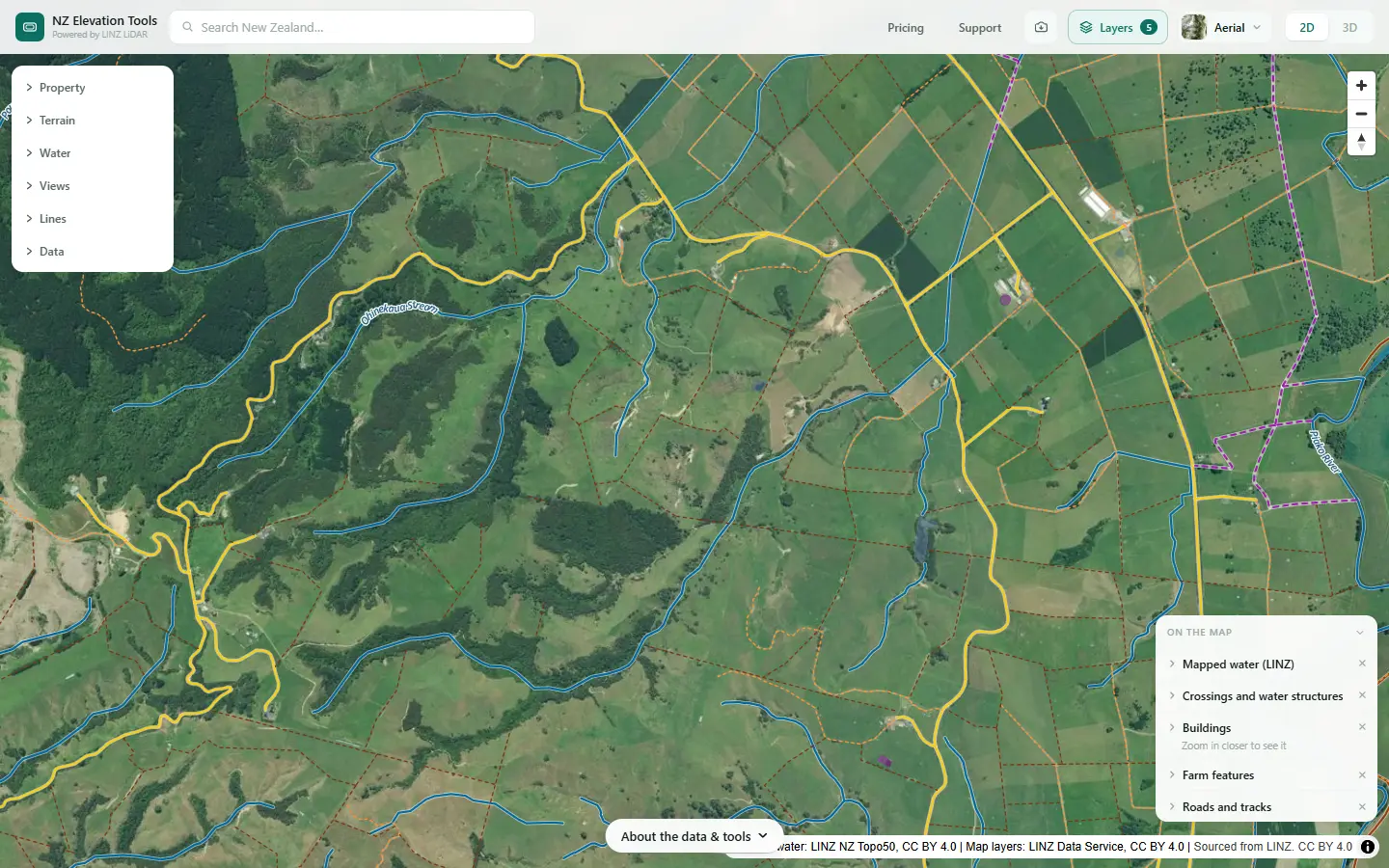
Turn on Crossings and water structures, Roads and tracks, Farm features and Buildings in the Layers menu, with Mapped water. You see the bridges, fords, stopbanks, roads, tracks, fences and buildings LINZ has mapped, over the streams.
Measure what drains to each crossing
Open Catchment and click the stream where the track crosses it. It maps all the land draining to that point, in hectares: the first number for sizing a culvert or checking an existing one.
Follow the runoff off the track
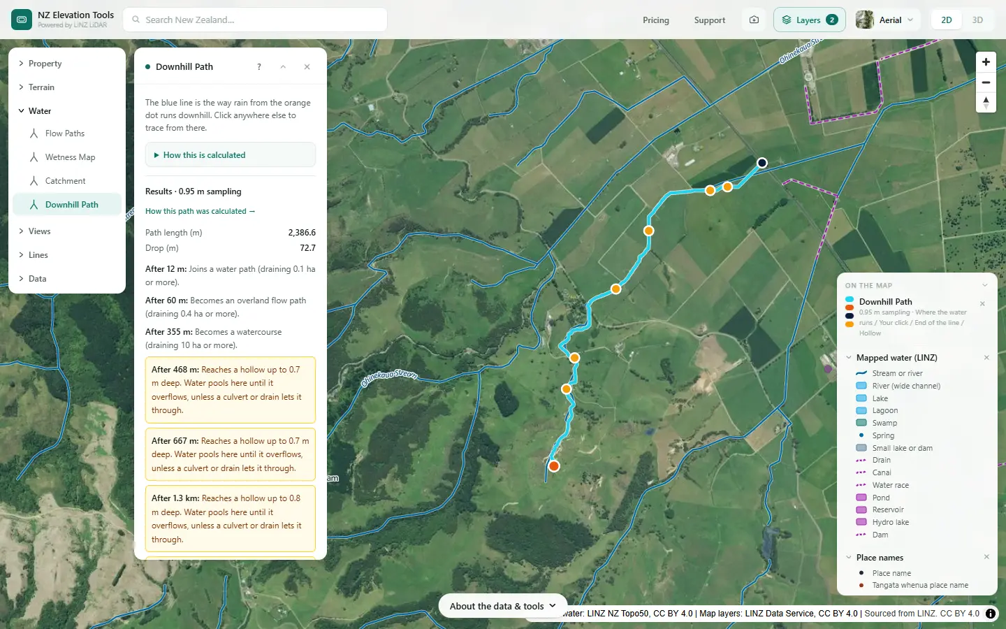
Click a spot on the track above a crossing. Downhill Path shows where its runoff goes: along the track, into a swale, or straight into the stream. That is where a cut-out or a water table turn-off does the most good.
See the flow paths the crossing has to pass
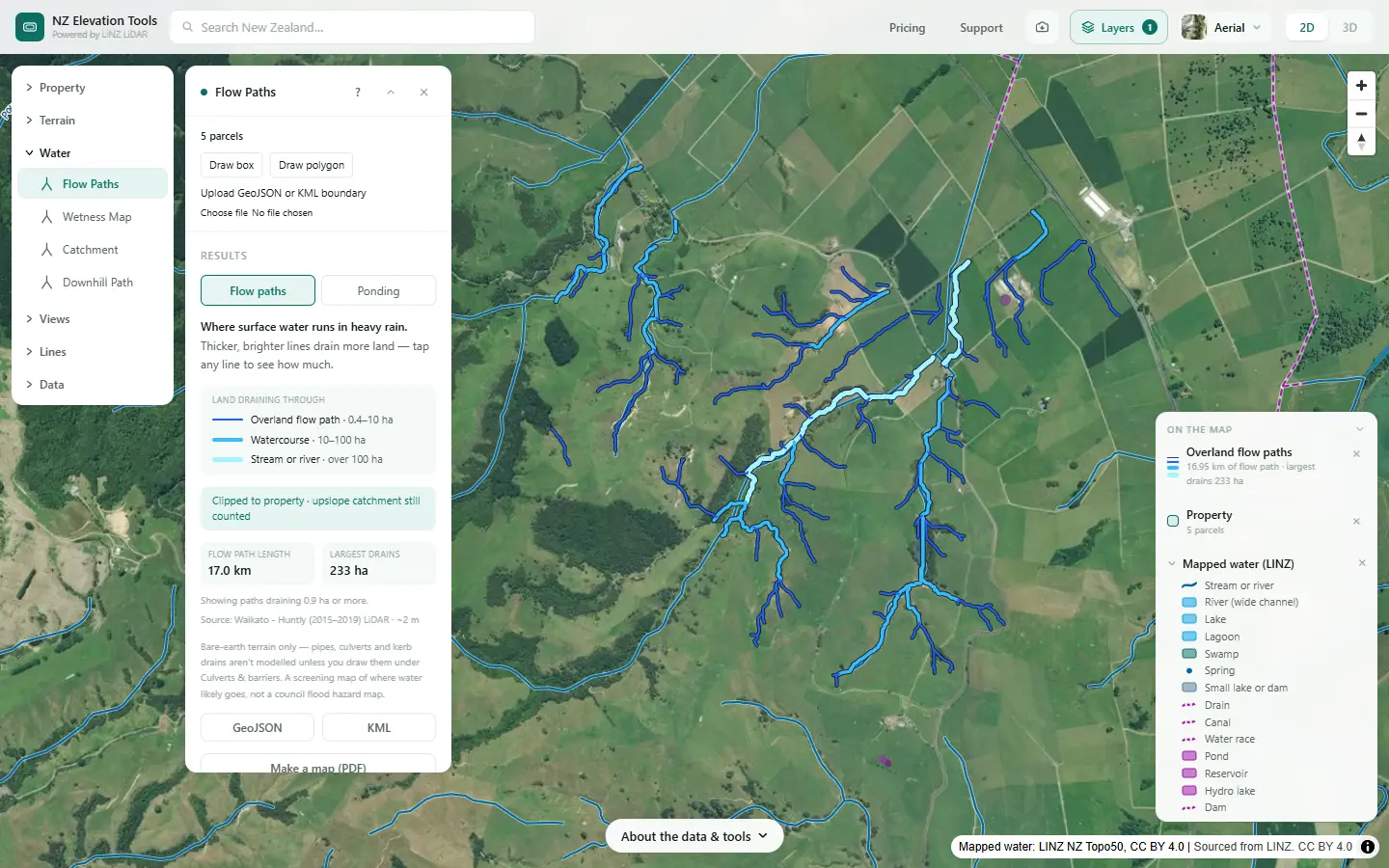
Run Flow Paths. Every place a track crosses a flow path is a spot where water will run across or under it in heavy rain, whether or not there is a stream on the map. Tap the line for the hectares draining through.
Plan a new track
Route Explorer finds a route between points that keeps under a maximum grade. Run Flow Paths alongside it to see how many flow paths each option crosses, and where it could cross the stream on a short, straight reach.
Route Explorer →Size the culverts
Saving the maps as images is free. With a pass, the catchment outline exports as DXF, GeoJSON or KML.
What this cannot tell you
- Where your culverts are. They are not on the LINZ map. Mark them, and draw them in the water tools.
- What size a culvert should be. The catchment area is the start; rainfall, slope and an engineer do the rest.
- Every track. The map shows the main formed tracks at 1:50,000. Races and newer tracks are often missing.
- The rules for crossings. Regional councils set them for new crossings and stock in water. Ask before building.
Related guides
- Catchment area for a culvert or stream crossing
- How much riparian fencing do I need?
- Critical source areas
- Farm maps for a freshwater farm plan
Screenshots from NZ Elevation Tools of a dairy and drystock farm on the edge of the Piako flats in the Waikato, with legal descriptions and owners blurred. Aerial photos and LiDAR from LINZ. Sourced from the LINZ Data Service and licensed by Regional Software Holdings Limited and Waikato Regional Council for re-use under the Creative Commons Attribution 4.0 International licence.
Frequently asked questions
What crossings does a farm plan need to show?
Every place stock or vehicles cross a stream, river or drain: bridges, culverts and fords, and unformed crossings where stock just walk through. Crossings matter because stock in water add dung and stir up sediment, and an undersized culvert can wash out.
Are culverts on the LINZ map?
No. The topographic map shows bridges, fords, floodgates and siphons, but not culverts. Mark yours from the farm, and draw them in the water tools under Culverts & barriers so the flow paths go through them.
How big should a culvert be?
It depends first on how much land drains to it, then on rainfall, slope and what is downstream. Catchment gives the area in hectares, the first number in every farm culvert table. Regional council guides and an engineer do the rest.
Why do tracks matter for water?
Tracks and races are compacted and often bare, so they shed water early and carry soil and dung with it. Where a track runs downhill to a crossing, its runoff goes straight into the stream. Cut-outs that turn water off the track onto grass every so often keep it out.